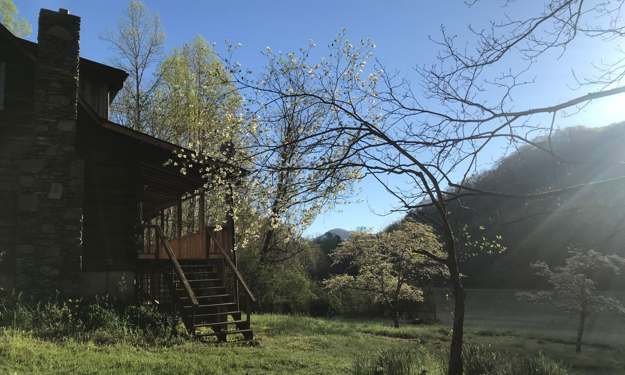
There is no shortage of beautiful road rides in Asheville. Unfortunately, it can put a damper on your day dodging traffic and hoping the guy driving behind you is paying attention to you instead of his phone and the view. Consequently, I set out to create a ride with lots of elevation change and lots of scenery, but not lots of traffic.
Trip Report: I headed SW out of the Green River Ranch on a sunny, winter afternoon. Right out of the gate I was greeted with nearly 2 miles of gently undulating pavement following the scenic Green River. It was the perfect warm-up for what was just ahead. Rolling past Fishtop, it was game on. The next 2.5 miles were truly a challenge as the pavement climbed nearly 1,000 vertical feet. Dead smack in the middle was a section with grades exceeding 20%. I’m pretty sure John Cougar was riding this very stretch of tarmac when he was inspired to write his hit classic, “Hurts So Good”! On my way up I encountered a dozen brave sole’s zooming down on longboards. There was no doubt they were enjoying themselves too!
Upon reaching the top and making a right on Ozone Rd, my heart had time to recover as I rolled through the quintessential small town of Saluda. I made a mental note to stop for a craft beer and custom made deli sandwich at Thompson’s Store on the way back. Thompson’s is the oldest grocery store in the entire state. It’s also located at the “top of the grade”, the steepest standard-gauge mainline railway grade in the United States. After my own climb, it was only fitting to turn here onto Greenville St. 5 miles later I found myself crossing into South Carolina and entering the Greenville Watershed. Rolling through the Watershed proved to be quite scenic. Most of the Watershed followed gurgling waters with occasional cascades on Fall and Posey Creeks.
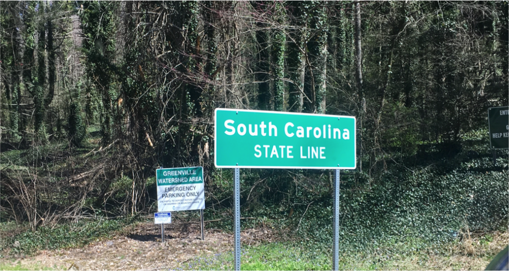
What is it about biking into a different state that provides an instant sense of accomplishment???
Crossing back into NC I found myself at Talisman Camp Trailhead for the Saluda Mountains Passage of the Palmetto Trail (a great 9-mile hike, which I’ll have to report on another day). Realizing this was about the half way point on the ride, I thought it would be a perfect place to stop for a snack. One thing I have discovered is that you can always expect to see the unexpected at some point on a long road ride through rural America. This was that point in time.
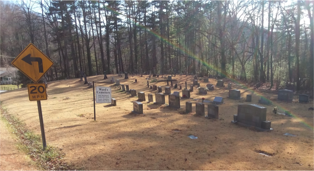
If you look closely you’ll notice 2 things. First, although it was a very sunny day with no rain in sight, there is a rainbow ending in the cemetery. Second, there is a sign with contact information for two different individuals. Is the cemetery for sale??? Are they selling plots? Surely that’s not necessary. People are already dying to get in. Moving along…
Up next was Lake Summit. I chose S. Lake Summit Rd, but you could just as easily take N. Lake Summit. Both are hard-pack surfaces, and both provide tremendous views of the brilliant blue-green waters and cottages/boathouses that grace the water’s edge. Leaving the lake I found myself climbing switchbacks on a hard-packed surface. It was at this point, that I began to realize that the ride resembled an Italian spring classic. With a little imagination, I could pretend I was riding Paris-Roubaix.
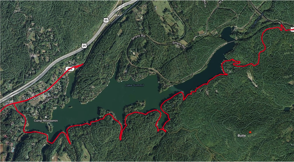
With a hard-packed surface and hard climb out, the ride started to have a feel like an Italian Spring Classic
The next 6 miles consisted of more scenic, paved and hard pack backcountry roads that rolled up and down and back and forth until I was back in Saluda and the big climax. While climbing 1000 vertical feet over 2.5 miles (discussed at the beginning of the trip report) has its own virtues, the descent is a pure cycling paradise. From top to bottom there are 56 curves, including 17 switchbacks.
Enjoy the reward, you earned it… but please exercise a little caution. Remember the short 20% grade previously mentioned? It can sneak up on you. I actually locked up my rear wheel… while approaching an apex… with a pickup coming my way. In the end, however, it was just a little added excitement. Once you reach the bottom, the final 2 miles serve as a nice cool down ending back at the Green River Ranch.
Click here for a map of this ride, here for Strava details, or here for Google Maps turn by turn directions.